Introduction
Executive Summary
Successful cities and communities are usually equipped with sufficient provision of houses, retails and public spaces so that the needs of different groups of people can all be met. The value of these features create together is larger than their values as parts. Parks and green spaces are important parts of the living environment, which have a huge role in determining how welcoming and healthy a city is. Besides huge social and health benefits, parks and green space also create a massive financial impact. According to the 2015 City Park Facts Report, the total economic value generated in 2015 is one hundred and twenty-six billion more than the total governmental spending on parks. The project aims to measure the economic value of Starlight Park, a 13-acre park located in Bronx, NY. We intend to use PIR sensors and Wi-Fi sniffers to detect the person visits of three main types of park direct uses including general park uses, park facilities use and special uses. Each type of park direct uses is assigned a dollar value based on people’s “willingness to pay” for similar recreation experience in the private marketplace. By adding them together we can obtain the economic value of the park. Due to a bunch of limitations, data collected in this project is not enough to tell the story of Starlight Park. However, the methodology proves that there could be a relationship between the design of public space and its uses that we can rely on. The fact that we could not get the information we want gives us some frustrations. While in the meantime it shows how far we could go from data privacy and efficiency based on the fact that we still need to deal with data privacy issues and other legal procedures in such practice. This pilot is the first step for us to create a smart system for a park or other types of public space in the future. It also, in a meaningful way, leads to further investigations of how to deal with urban matters based on what we need.
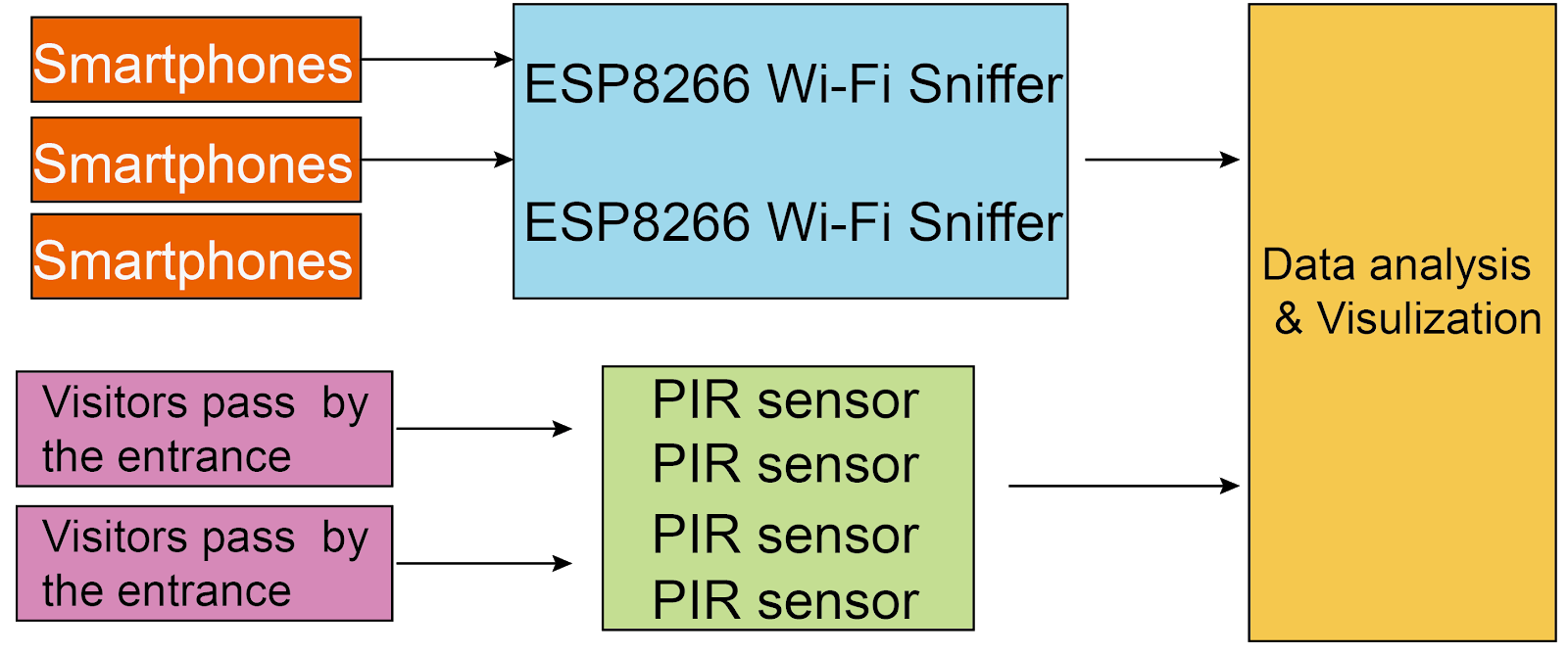
Figure1. System infrastructure
Hero Picture
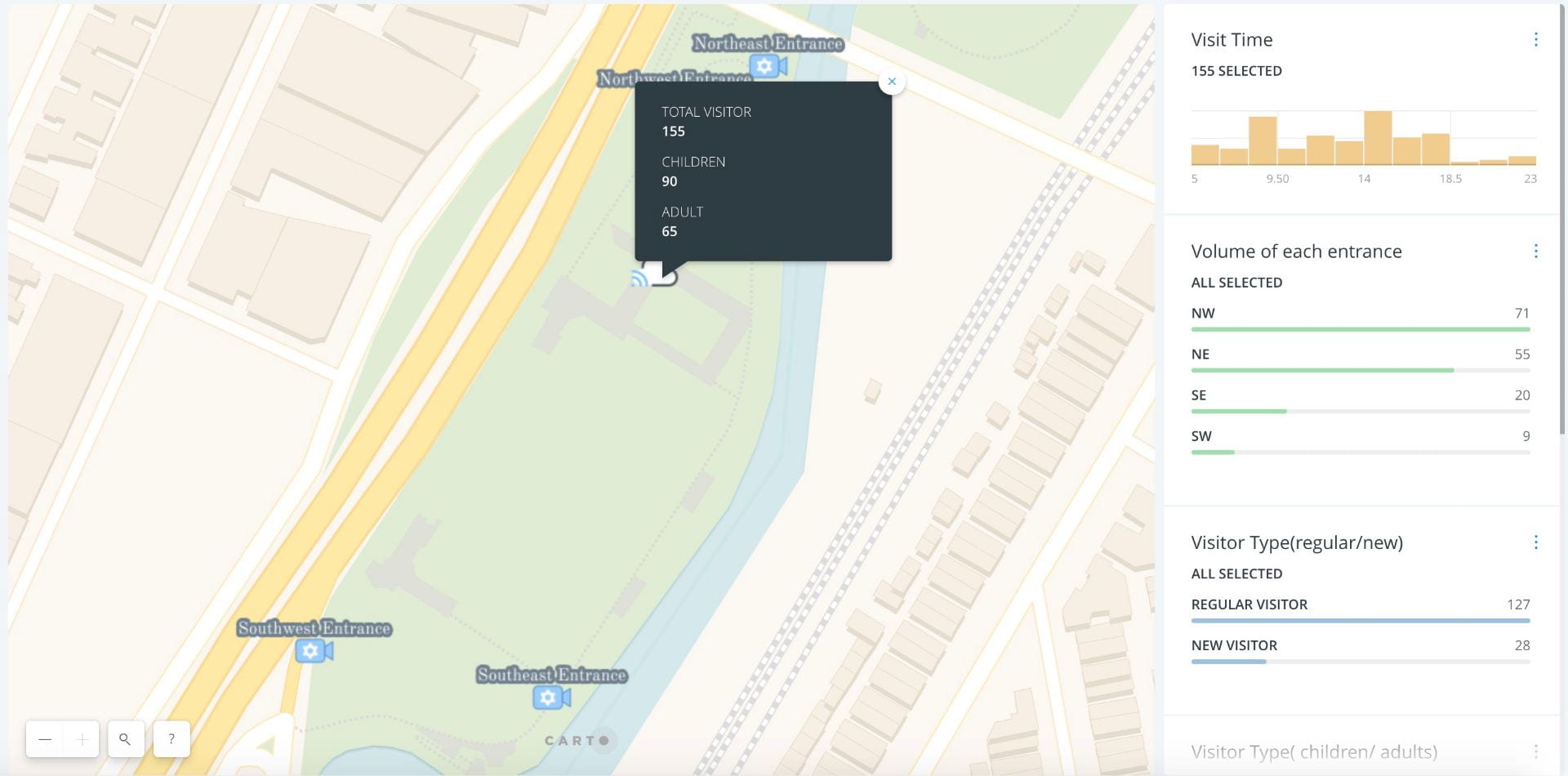
Figure2. Interactive web map demonstrating the data visualization (Link:https://yichenouyang.carto.com/builder/29ecfe93-e65e-468d-9720-8d4a20c6a408/embed)
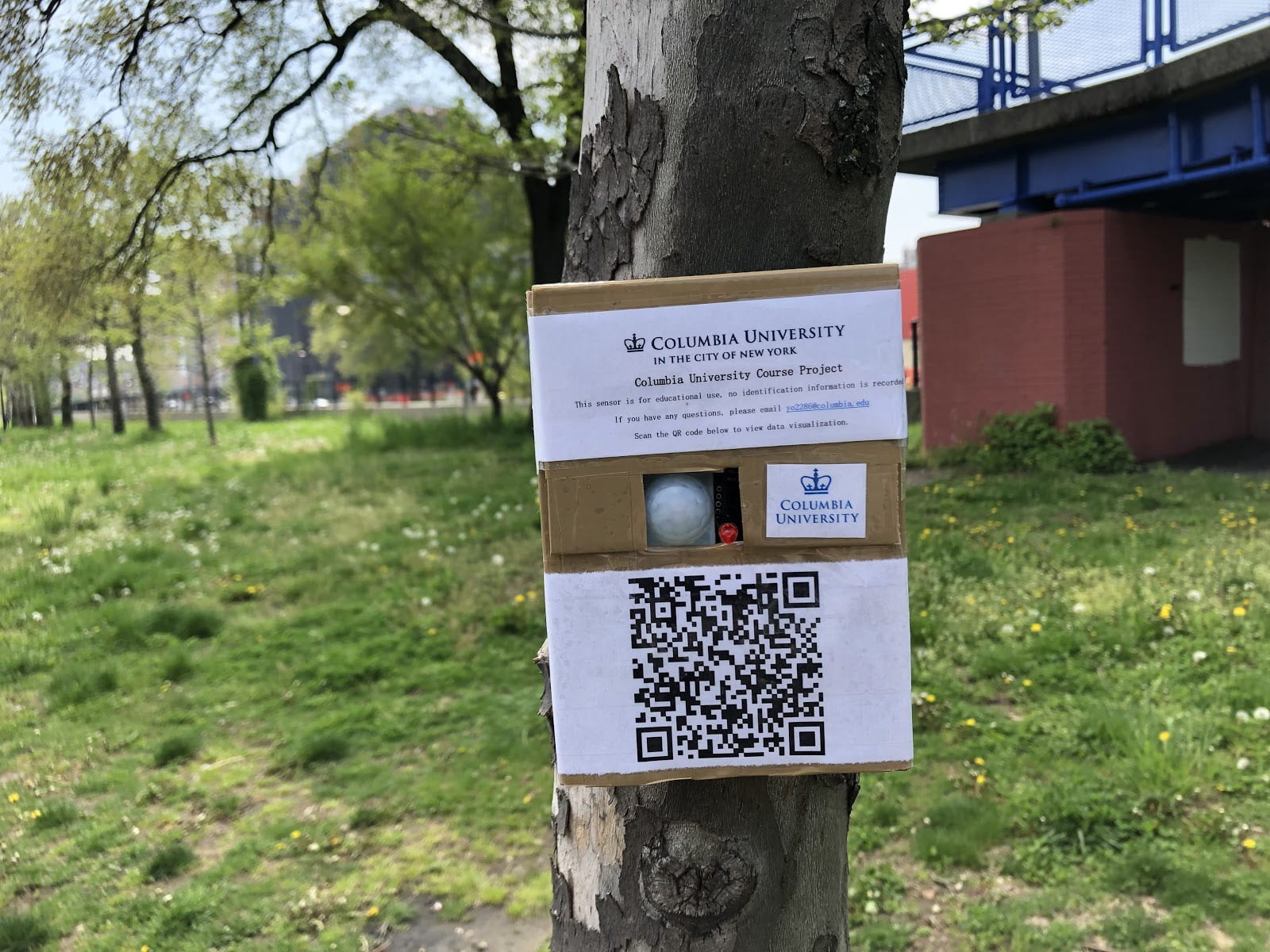
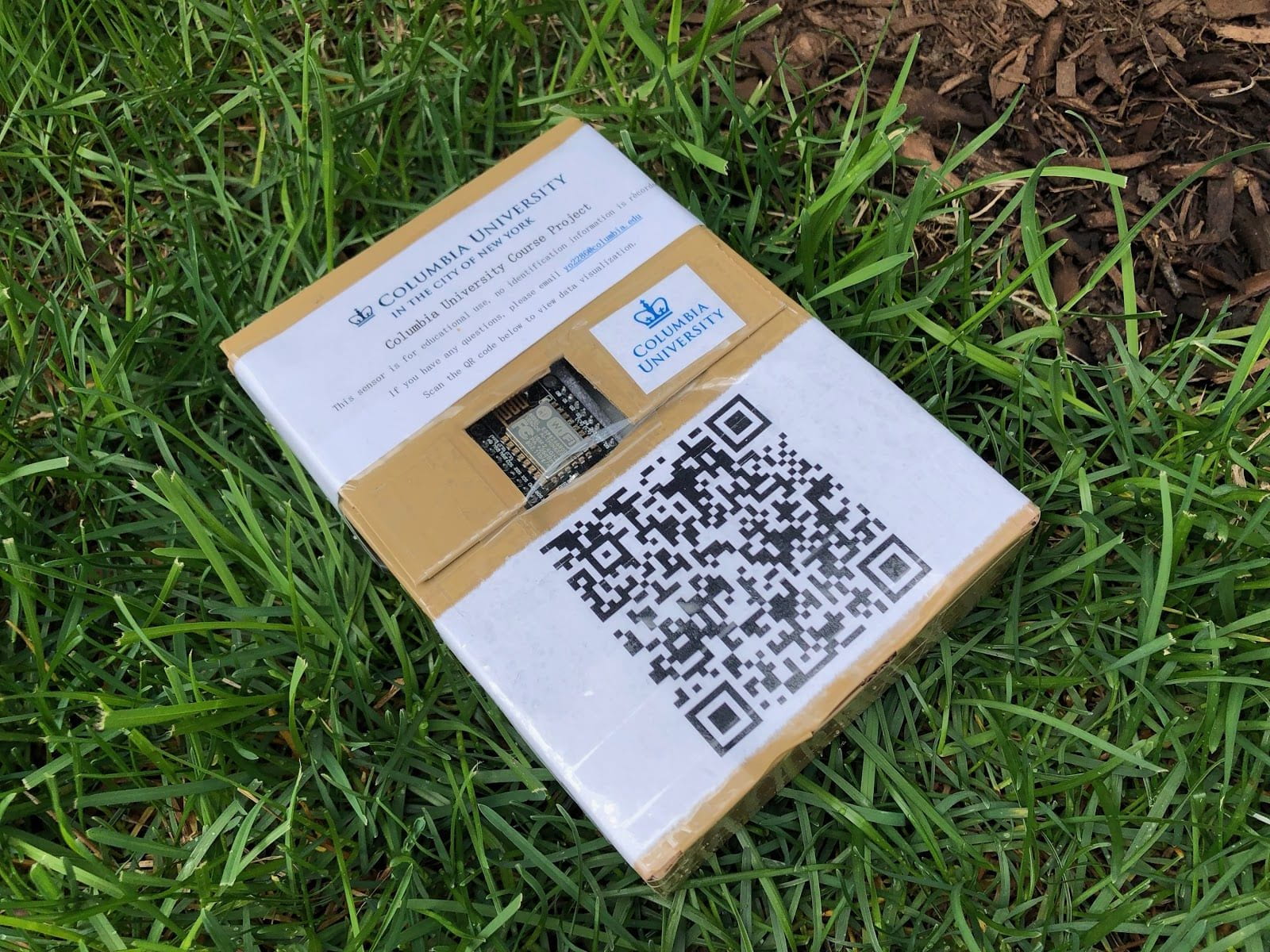
Figure3. PIR sensor and Wi-Fi sniffer
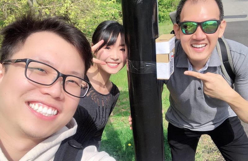
Figure 4. Pilot in Starlight Park
Team Names, and mechanism for contact
- Danting Luo <9173464774>;<dl3149@columbia.edu>
- Yichen Ouyang <6466233632>; <yo2286@columbia.edu>